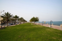
Al-Fanateer Beach is one of the beaches in the Kingdom of Saudi Arabia , located in al-Jubayl Industrial City in the Eastern Province . It spans an area of 19.3 ha and features a sandy shoreline stretching one thousand m, under the supervision of the Royal Commission for Jubail. Al-Fanateer Beach facilities Al-Fanateer Beach offers various facilities, including green spaces, palm-thatched pergolas, children’s play areas, a fitness training zone, and a marina. The beach also features the...

The National Gravity Network consists of a network of points covering the areas of the Kingdom of Saudi Arabia . It serves to measure absolute and relative gravity values. It seeks to support and develop geodetic activities and maintain vertical reference frames and the Kingdom's geoid model. It leverages gravity-related data, such as those concluded from determining flood paths, monitoring volcanic activity, and correcting cadastral survey readings, and shares such data with users. Elemen...
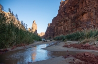
The Springs in the Kingdom of Saudi Arabia are one of the water sources in the Kingdom. Several springs of historical significance to residents and travelers have been discovered, most of which are concentrated in the Arabian Shield west of the Kingdom due to its sedimentary layers and groundwater reserves. The southwestern springs in as-Seeh area (at the Kingdom's center) are among the most notable, characterized by their abundant waters and unique basins. Concept of water springs Springs...
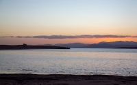
The last two places where the sun sets in the Kingdom of Saudi Arabia are Tiran Island and Ras al-Sheikh Hamid in Tabuk Province , at the junction of the Gulf of Aqaba with the Red Sea. Tiran is one of the islands of natural importance in the Kingdom and is the third largest Saudi island in the Gulf of Aqaba and the Red Sea in terms of area, after Farasan al-Kabir Island and Sajid Island. ...
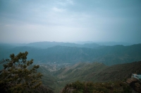
The Arabian Shield region extends along the Red Sea coast and the Gulf of Aqaba in the Kingdom of Saudi Arabia , from Jordan in the north to the Saudi-Yemeni border in the south. It spans the provinces of Tabuk , al-Madinah al-Munawwarah , Makkah al-Mukarramah , al-Bahah , Aseer , and Jazan . The Arabian Shield covers an area of 630,000 km 2 , representing 32 percent of the Kingdom's land area. Its width ranges from fifty to one hundred km in the north, expands in the center to reach a max...
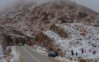
Snow falls on the heights of NEOM in Tabuk Province , located in the northwest of the Kingdom of Saudi Arabia, at the beginning of winter each year. These heights experience heavy snowfall during the months of December, January, and February. Among NEOM heights covered with snow during the winter season are Jibal ad-Dhahr, Alaqan, and Jibal al-Lawz. Jibal al-Lawz is one of the highest mountain ranges in Tabuk Province, reaching an elevation of about 2,549 m above sea level. Al-Lawz Heights also...
Saudi Geographical Society (SGS) is a scientific society in the Kingdom of Saudi Arabia, affiliated with and operating under the direct supervision of King Saud University . It was established in 1971 to provide scientific consultations, conduct studies, and develop theoretical and practical knowledge for both the public and private sectors. On December 22, 1984, the first general assembly was held after the new SGS bylaws were adopted in 1983. SGS's bylaws were revisited again in 2000 in ...
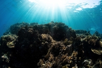
The borders of the Kingdom of Saudi Arabia overlook three seafronts: the Red Sea, al-Aqaba Gulf, and the Arabian Gulf. The Red Sea is renowned for its array of coral reefs in different patterns, shapes, and colors, boasting over two hundred species. Their formations have various shapes, some are ring-like structures enclosing shallow lagoons, while others resemble bays due to incomplete formation. Notably, coral remains compose most of the Red Sea's islands. The Arabian Gulf is hom...
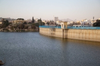
Abha Dam is a concrete dam located west of Abha City, Aseer Province Principality's headquarters, southwest of the Kingdom of Saudi Arabia. It was constructed during the reign of King Faisal Bin Abdulaziz Al Saud and inaugurated in 1974. The dam's construction costs amounted to about SAR35 million. It measures 350 m in length and thirty m in height. The dam's reservoir can hold up to 2,130,000 m 3 of water. The history of Abha Dam construction The first construction of Abha Dam w...
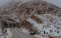
In the winter of 2022, Turayf Governorate, located in the Northern Borders Province , recorded a temperature of minus six °C, marking the lowest temperature in the past thirty years in the Kingdom of Saudi Arabia, according to the National Center for Meteorology . Winter in the Kingdom typically begins in mid-December and lasts until mid-March. The mountainous areas in the south and north of the Kingdom, as well as some low-lying areas in the north, experience the lowest temperatures. In the w...
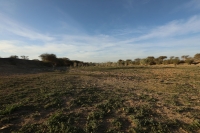
The Climate of the Kingdom of Saudi Arabia is characterized as a semi-arid to arid desert climate with hot days and cold nights, and low annual rainfall except for Aseer Province in the southwestern part of the Kingdom. The characteristics of Saudi Arabia's climate The Kingdom's climate is characterized by stability most of the year, due to its location in the hot desert region, between latitudes sixteen and thirty-two° north, with the Tropic of Cancer passing through its middle. Whi...
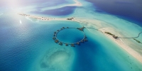
The Marine Nature of the Kingdom of Saudi Arabia comprises the features of its three coastal fronts on the two seas it borders: the Red Sea and the Arabian Gulf. The length of the Kingdom's coastlines is approximately 3,800 km. It has two coastal fronts on the Arabian Gulf to the east, extending 1,200 km, and a coastline along the Red Sea and the Gulf of Aqaba to the west, measuring around 2,600 km. This coastal nature has provided the Kingdom with economic, geographical, and geological si...