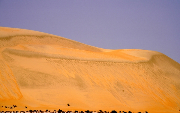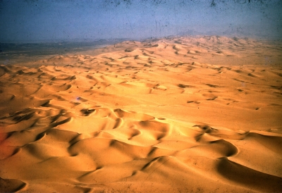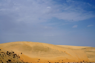
As-Sanam Area is one of the sandy regions located at the northern edges of al-Rub' al-Khali (Empty Quarter) in the Kingdom of Saudi Arabia. Most of it consists of semi-flat sand sheets, and it was named 'as-Sanam' (literally translates as camel hump) due to the undulating sand sheets that resemble the humps of camels in appearance.
Various small ergs (Uruq) and sand sheets spread throughout as-Sanam Area, where sand corridors, small dunes, sand hills, and elevated sand landmarks branch out, which are relied upon for navigation. In the northern part, large and long ergs decrease, and there are also sand flats and some of al-Hadh plants.
Location and nature of as-Sanam Area
As-Sanam Area is located at the northern edges of al-Rub' al-Khali (Empty Quarter) and extends southward in the form of a strip. As-Sanam, along with ad-Dakkakah Area at the southern edges of al-Rub' al-Khali (Empty Quarter), formed a barrier that contributed to dividing al-Rub' al-Khali (Empty Quarter) into two parts differing in the formation of their sand shapes and directions. The eastern part is characterized by star dunes, crescent-shaped dunes, and dome dunes, and contains Sabkhas (salt flats). The western part is characterized by longitudinal dunes (Uruq) between which lie longitudinal depressions (Shuqaq).
North of as-Sanam are areas such as al-Jayban, al-Jawb, al-Jafurah, and Madrakah. To the east are al-Mihradh, Sabkhat al-Kurnah, al-Mahakik, and al-Karsou. It is bordered to the south by al-Manjar, al-Buh, al-Turaiez, as-Sawahib, and ad-Dakkakah. To the west are Marbakh al-Faras, Uruq al-Falukh, ash-Shuwaykilah, and al-Habaqah.
Water in as-Sanam Area
As-Sanam Area contains many ancient water resources known for their sweetness, such as wells called Qalamat, including al-Ghariqah, al-Azyouh, Buraydan, al-Abaylah, Abu Sabl, Faysal, Jallab, and Faris. It also has several wells such as Bi’r Zibdah, ar-Ruhayt, ad-Duwaysir, al-Qaratis, Ibn Mihran, and Farjah. There are also a group of springs, Khiyaran, like Zughayn, Abu as-Safa, al-Lubada’a, Tabiyyah, Abu Ghawarib, and Salih. Among the water resources are al-Jiballiyyat, which are wells in al-Rub' al-Khali (Empty Quarter), such as Jiballiyyet as-Sa‘aquq, Abu Ghawarib, and Mashruqah.
Sand landmarks in as-Sanam Area
As-Sanam Area includes multiple sand landmarks, where the elevation of its sands ranges between one hundred m in the east and two hundred m in the west above sea level. Among the sand landmarks in the area are Farshat as-Sarah located on the northern edges, in addition to al-Zaba’air in Aba as-Siqan, Umm Shum‘ah, Shafi, Bayyinah, and Aalman located in al-A'asilah, Fadilah, and Tasbib. Other sand landmarks include sand sheets (Khuyut) in as-Safrah, Umm al-A'amad, and Nuwayr; sand dunes in al-Qara’ain, ad-Duway, and ar-Rumays; and sand flats (malsat) in Umm al-Hadid and at-Tariqa'a. The sand landmarks also include dunes in al-Falukh, Umm Thulum, al-A'abaylah, Qumaysan, and Haqin in al-Faghirah, al-Kiffaf, and Mu‘ayli as well as Hadhat formations spreading in al-A'abaylah, Faris, and Umm al-Hadid in the north.
Some sabkhasextend from Sabkhat Mity in the northeastern edges of as-Sanam Area to several locations, including Atiyyah, ash-Shaba'an, al-Hakb, al-Mabouth, Nayif, and az-Zahr.
Plants in as-Sanam Area
Various plants grow in as-Sanam Area, such as the haloxylon persicum, which grows widely in the north of as-Sanam. Also growing are al-A'andab and al-Hadh plants. In the southern part, al-Harm plant, al-Hadh, and al-Aabl spread.
Related quizzes
Related articles


