Search
Recommended search results

Metaverse Academy is the result of a partnership between Tuwaiq Academy and Meta Company, making it the first specialized academy of its kind in the Middle East and North Africa. It is also supported by Simplon, the leading French social enterprise that provides comprehensive digital skills training services. Goals and tracks of Metaverse Academy The academy seeks to qualify trained national cadres to support opportunities and businesses in the metaverse field and its various technologies aroun...

The Tech Research Challenge Initiative is a quarterly initiative focused on addressing technical challenges in the Kingdom of Saudi Arabia. It was launched by the National Technology Development Program (NTDP) in 2021, in partnership with King Abdulaziz City for Science and Technology (KACST), and in collaboration with Saudi companies, universities, and research centers. The initiative aims to localize the information technology sector in line with Vision 2030 and to encourage research, develop...
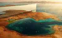
The Line is located in NEOM , northwest of the Kingdom of Saudi Arabia. It is a project to build a city with a new concept of sustainable urban development and has several advantages, including: It overlooks approximately 13 percent of global trade movement due to its location on the Red Sea coast. The city spans a width of two hundred m, stretching over 170 km, with an elevation of five hundred m above sea level. It is designed to accommodate around nine million residents and will be built ove...

Cybersecurity in the Kingdom of Saudi Arabia consists of the nation's efforts in providing a safe environment for digital processes and data through an effective security system. Moreover, it seeks to develop, implement and supervise the national cybersecurity strategy. Cybersecurity in Saudi Arabia is a crucial governmental body supported by the National Cybersecurity Authority and the Saudi Federation for Cybersecurity, Programming and Drones. Role of cybersecurity in Saudi Arabia The ...
Saudi Arabia National Spatial Reference System (SANSRS) is one of the programs within the National Geodetic Infrastructure at the General Authority for Survey and Geospatial Information. It is a fixed reference system that defines Cartesian coordinates, longitude, latitude, elevation, scale, gravity, and orientation throughout the Kingdom of Saudi Arabia. 1 2 The National Spatial Reference System consists of the following geodetic components: Geodetic Reference Frame (KSA-GRF), Vertical Referen...