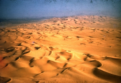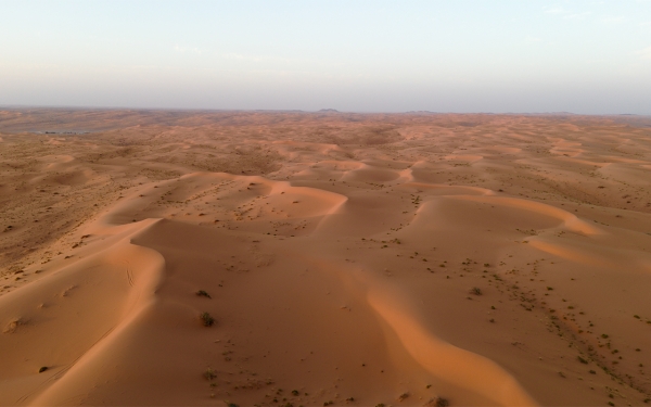
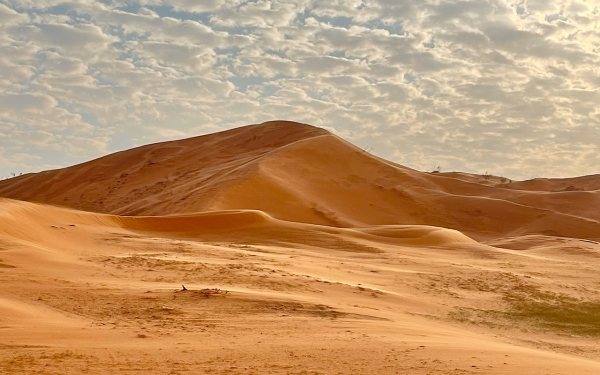
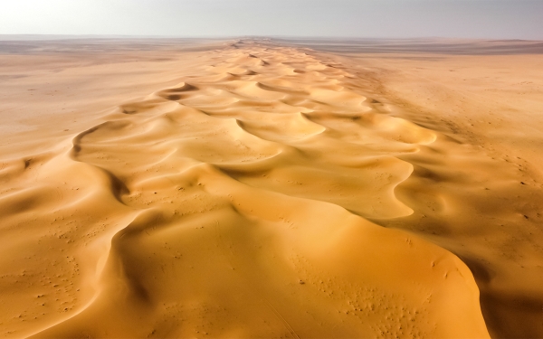
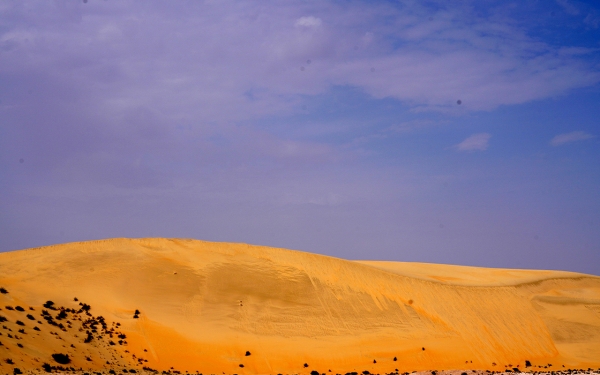
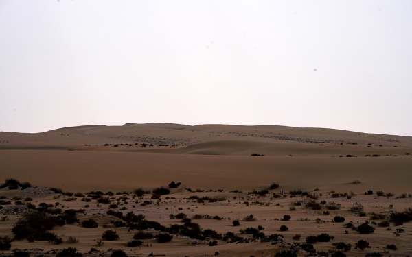
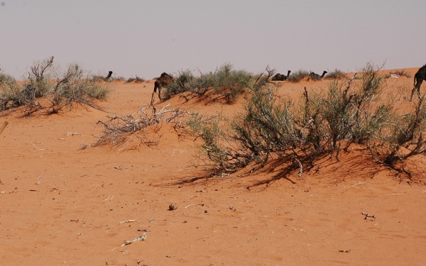
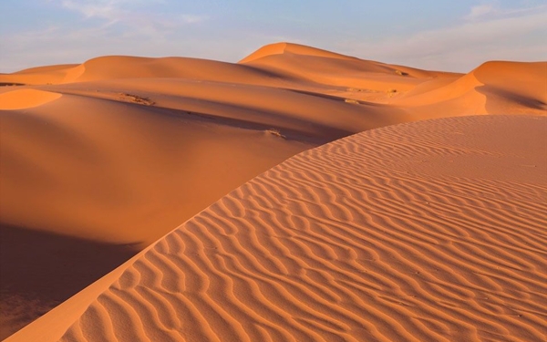
The deserts of the Kingdom of Saudi Arabia are the sandy accumulations spread across the country's map. Despite the prevailing stereotype that the Kingdom is a desert country, deserts only represent 31.75 percent of its diverse surface features. Within the range of the Kingdom's deserts lies the Empty Quarter Desert, the largest continuous gathering of sand in the world. The deserts have various names in the local dialects, including: Nufud, Ti's, Uruq, Irq, and Niqa.
Given the vastness of the Kingdom's territories, it encompasses a diversity in its natural terrains. The western highlands stretch along the Red Sea coast and the Gulf of Aqaba. At an elevation of 3,015 m, al-Soudah Mountains stand as the highest peak in the Kingdom. The eight plateaus in the Kingdom are located in the western, eastern, and central parts of it, with four of them forming part of the borders with Yemen, Jordan, and Iraq. The eastern part of the Kingdom is distinguished by its sand accumulations, with 90 percent of the total sand in the Kingdom located there. The largest is the Empty Quarter Desert, covering an area of 430,000 km², followed by the Nafud desert.
Deserts of Saudi Arabia
Area of the deserts of Saudi Arabia
The deserts in the Kingdom cover an area of about 635,000 km². They are part of the geography of nine administrative provinces out of a total of thirteen provinces in the Kingdom. Most of them formed within the scope of the Arabian Shelf in the east of the Kingdom, while another part lies within the boundaries of the Arabian Shield in the west. They consist of continental sands in the Arabian Shield and marine sands originating from the Arabian Gulf.
The Empty Quarter Desert, located in the east and southeast of the Kingdom, occupies the largest portion of the total desert area of the Kingdom, representing 67.7 percent of it. It is the driest and hottest part of the Kingdom, with an average annual temperature ranging from twenty-seven degrees to thirty-two degrees Celsius. Alongside al-Dahna, Nafud al-Kabir, and al-Jafurah deserts, it represents the four largest sand accumulations in the Kingdom, accounting for 90 percent of the total sandy areas.
The sand formations that make up al-Dahna desert, the third largest desert in the Kingdom after the Empty Quarter Desert and al-Nafud al-Kabir, are distributed across five Saudi provinces: Riyadh, al-Qassim, Eastern Province, Hail, and the Northern Borders, spanning an area of up to forty-five thousand km².
Natural reserves in Saudi Arabia's deserts
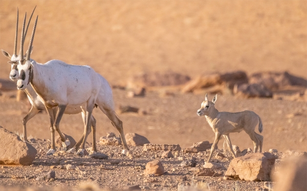
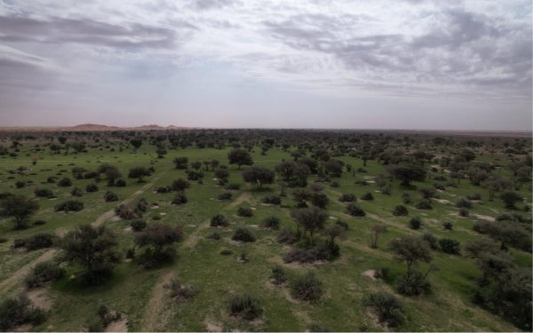
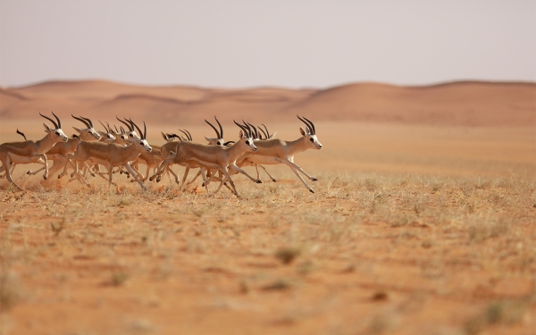
The Kingdom's deserts are distinct for a number of natural reserves where flowing torrents and streams from nearby valleys contribute to their vegetation cover. The deserts are home to several species of animals such as the Arabian oryx, the mountain gazelle, the goitered gazelle, ostriches, hares, the Arabian wolf, hyenas, the sand cat, the hyrax, the chlamydotis, eagles, the partridge, and the Pterocles. In the deserts of the Kingdom, more than fifty types of trees, shrubs, and grasses grow, such as: Ziziphus spina-christi, Haloxylon persicum, Aerva javanica, Acacia, Calligonum comosum, Moringa, Haloxylon, Lycium shawii, Peganum, and Rhanterium.
Royal reserves in Saudi Arabia's deserts
Some reserves have been converted into royal reserves to conserve their flora and fauna. In 2018, the Council of Royal Reserves was established, which falls under the Saudi Royal Court. These include King Salman Bin Abdulaziz Reserve (formerly known as al-Khanfah, al-Tabiq, and Harat al-Hurrah) in al-Nafud al-Kabir Desert, the Imam Abdulaziz Bin Mohammed Reserve (formerly Rawdat Khuraim), King Abdulaziz Reserve (formerly al-Tanhat) in al-Dahna Desert, and the King Khalid Royal Reserve (formerly al-Thumamah).
The desert's connection to the Saudi identity
The desert and all that it symbolizes hold a prominent place in local memory. It was home to many tribes in the Kingdom before King Abdulaziz Bin Abdulrahman Al Saud's initiative to localize the nomads. Nowadays, leisure activities in the desert are common, especially during the winter season.
Saudis tend to engage in desert sports and hobbies, which also attract foreign tourists. Such activities include camel racing, car rallies, hunting trips (al-Miqnas), and driving 4x4 vehicles over sand dunes(al-Ta'as), camping or desert picnics (al-Mikshat), and desert-crossing trips either by vehicles or on foot.
Natural resources in Saudi Arabia's deserts
The deserts of the Kingdom are home to the most significant natural resources, upon which the national economy relies, such as oil and gas. In the Empty Quarter Desert, the Saudi Arabian Oil Company (Aramco) operates the world's largest crude oil field, the Ghawar Field, with reserves reaching 58.32 billion barrels. Also, the Shaybah Field has reserves of 14.86 billion barrels. Additionally, in al-Jafurah Desert, the largest unconventional gas field operates with estimated reserves of 200 trillion cu ft of raw gas.
The Empty Quarter Desert
The naming of Empty Quarter Desert
The Empty Quarter Desert was named as such due to its relative emptiness of inhabitants and scarcity of animal and plant life. It is classified as one of the hottest and driest regions in the Kingdom. The average annual rainfall in the area is less than fifty mm, and the temperature during summer can exceed fifty degrees Celsius.
Area of the Empty Quarter Desert
The Empty Quarter Desert is the largest sand accumulation in the territory of the Kingdom and the most expansive continuous sand in the world. Its area within the Kingdom covers 430,000 km². It is primarily located in the southeast of the Kingdom, occupying parts of three administrative provinces, namely, Eastern Province, Riyadh, and Najran. It accounts for 67.7 percent of the total desert areas in the Kingdom and 21.5 percent of the Kingdom's overall land area.
The Empty Quarter Desert forms one of the landmarks of the Arabian Shelf, the second geological component of the Kingdom, in addition to the Arabian Shield. It is also considered a part of the Arabian Desert, the fourth largest desert in the world, which spans across eight Arab countries and covers an area estimated at more than two million km². The sands of the Empty Quarter Desert extend to four Arab countries, the Kingdom, the United Arab Emirates, Oman, and Yemen, with a total area of 550,000 km², of which 78.2 percent is within the Kingdom.
Natural reserves in the Empty Quarter Desert
The Empty Quarter Desert is interspersed with two natural reserves to protect the few species of wildlife within it. They are Shaybah Reserve, affiliated with the Saudi Arabian Oil Company (Saudi Aramco), covering an area of 637 km², and Uruq Bani Ma'arid Reserve, located southwest of the Empty Quarter Desert, spanning over an area of 12,787 km², and is managed by the National Center for Wildlife Development.
Uruq Bani Ma`arid Reserve
It is one of the natural reserves in the Kingdom, located on the southwestern edge of the Empty Quarter Desert. By car, it is about 385 km away from Najran City to the north. It includes a number of important natural geological formations and habitats, such as high sand dunes and a fragmented limestone plateau. It is the only reserve located in Najran Province.
It was established during the reign of King Fahd Bin Abdulaziz Al Saud in 1993. It is the third-largest reserve overseen by the National Center for Wildlife in terms of area, with a size of about 12,787 km². The protection programs rea divided into preserr wild animals and the second for the environment and trees.
The Uruq Bani Ma'arid reserve is the first model reserve in the Kingdom where modern techniques are implemented, using drones for surveillance, conducting surveys, and environmental studies. Additionally, the reserve utilizes renewable energy, follows environmental sanitation guidelines, develops an environmental tourism program, engages the local community, and adopts a sophisticated management plan for the reserve.
Shaybah Reserve
Shaybah includes a fenced wildlife reserve, which is affiliated with Saudi Aramco, and it covers an area of 637 km². Within the reserve, there are ten endemic Arabian species, and thirty-nine species listed on a national list that includes fifty species with high conservation priority. Additionally, thirteen species are regionally threatened with extinction. Biodiversity surveys revealed the presence of eleven species of local plants, thirteen potential species of reptiles, eighteen species of mammals, and 176 species of birds, of which 169 species are migratory.
In 2019, the wildlife reserve in Shaybah underwent an external audit and obtained the ISO 9001 certification for quality management. In addition to that, Shaybah's production management has won the President's Award for Environmental Conservation twice. Moreover, in 2010, it received the award for the best industrial facility in terms of environmental aspects among the Gulf Cooperation Council countries. In 2018, the management received the Saudi Aramco President's Excellence Award.
Components of the Empty Quarter Desert
The Empty Quarter Desert consists of salt flats and dunes that reach a height of 1,160 m above sea level and 210 m above ground level. Its sands glow with a reddish-golden color. Beneath these sands lie some of the Kingdom's most important oil and gas resources.
At the depth of the desert, specifically on the southeastern edges of the Empty Quarter Desert, the Shaybah oil field facilities, discovered in 1968, are located. The field contain a certain oil reserve of 14.86 billion barrels of oil equivalent.
Al-Ahsa Oasis
Al-Ahsa Oasis is located amidst the sands of the Empty Quarter Desert. It is a World Cultural Heritage site and serves as a cultural tourism front for the Kingdom. The fertility of its lands, the spread of palm trees, and the presence of water springs have led to describe it as the largest palm oasis amidst the sands in the world. Administratively, the oasis falls under al-Ahsa Governorate, which is the largest governorate in the Kingdom in terms of area. This governorate, in turn, is part of the Eastern Province, which is the largest province in the Kingdom by area. Al-Ahsa Oasis is the fifth Saudi site to be registered on UNESCO's list of World Heritage sites.
The oasis spans across an area of more than eighty-five km² and is about forty km away from al-Uqair port, the oldest seaport in the eastern part of the Kingdom on the Arabian Gulf coast. There is a distance of ninety-eight km separating the oasis from the Ghawar Field, the largest crude oil field in the world. Jabal al-Qara, which rises about 150 feet, is one of the most famous tourist attractions and natural landmarks within the oasis.
Al-Nufud al-Kabir Desert
Area of al-Nufud al-Kabir Desert
Al-Nafud al-Kabir is the second-largest sand accumulation in the territories of the Kingdom, after the Empty Quarter Desert. It covers an area of sixty-five thousand km². It is located in the northern part of the Kingdom and spans across three administrative regions; Hail Province, al-Jouf Province, and Tabuk Province, accounting for 10.2 percent of the total desert areas in the Kingdom.
Al-Nafud al-Kabir Desert forms one of the features of the Arabian Shelf, the second geological component of the Kingdom in addition to the Arabian Shield. It is connected to al-Dahna Desert, the third-largest sand accumulation in the Kingdom, located in the eastern and northeastern parts. The edges of al-Dahna Desert connect with the Empty Quarter Desert, which is the largest continuous sand expanse in the Kingdom.
Location of al-Nafud al-Kabir Desert
The sands of al-Nafud al-Kabir Desert extend from the borders of the historic Najd region, specifically from al-Zulfi governorate in the Riyadh Province, to the northern borders of the Kingdom with Jordan. The sands of al-Nafud al-Kabir Desert replenishment al-Dahna Desert due to the winds blowing over them. Their sands are colored red, forming crescent-shaped formations and cavities, creating longitudinal, transverse, and pyramidal dunes.
Jubbah Archaeological Site
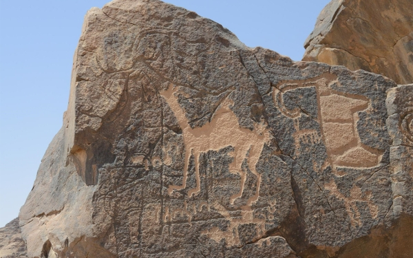
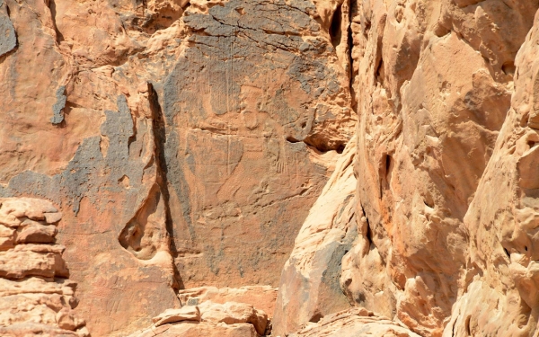
Al-Nafud al-Kabir Desert southern part contains rock inscription sites specifically in Hail Province. It is the fourth Saudi site listed on the UNESCO World Heritage in 2015. It is one of the oldest rock inscription sites in the Kingdom, dating back to more than ten thousand years BCE.
Nature reserves of al-Nafud al-Kabir Desert
Al-Nafud al-Kabir Desert includes three nature reserves: Harrat al-Hurrah Reserve to the north of al-Nafud, al-Tabiq Reserve, and al-Khanfa Reserve in the center. They are overseen by the Council of Royal Reserves after a royal decree was issued in 2018 to transform these three reserves and the areas adjacent to them into a royal reserve named King Salman Bin Abdulaziz Reserve.
King Salman Bin Abdulaziz Reserve
It is one of the royal reserves in the Kingdom, extending from the western edge to al-Nafud al-Kabir Desert north of Tayma Governorate up to the northwestern borders of the Kingdom with the Hashemite Kingdom of Jordan. On June 2, 2018, a royal decree was issued to transform al-Khanfa, al-Tabiq, and Harat al-Hurrah reserves, and the areas situated between and adjacent to them, into a royal reserve named King Salman Bin Abdulaziz Reserve.
The area of the King Salman Bin Abdulaziz Al Saud Reserve extends to about 130,700 km², making it the largest royal and natural reserve in the Kingdom. It is affiliated with the Council of Royal Reserves, which is chaired by the Crown Prince and Prime Minister, Prince Mohammed Bin Salman. The reserve's management council is headed by Prince Abdulaziz Bin Saud Bin Nayef.
The Harrat al-Hurrah Reserve, which was incorporated into King Salman Bin Abdulaziz Al Saud Reserve, is the first natural reserve in the Kingdom, established in 1987. Its landscape consists of a volcanic plateau, abundant with black basaltic rocks. In addition, the reserve features a range of low volcanic mountains with elevations ranging from eight thousand to 1,150 m above sea level. The reserve also houses perennial and annual plants that typically grow in the courses of flash floods and along their sides.
The natural environments in King Salman Bin Abdulaziz Reserve are diverse. A portion of it, especially in al-Tabiq mountains, is described as rugged. This area is known for its sparse vegetation due to overgrazing and tree-cutting before the establishment of the reserve. However, the valleys are abundant with trees such as Acacia and Barbary matrimony vine, along with various shrubs and herbs. The Nubian ibex is one of the most prominent animals in this area, in addition to small numbers of Arabian oryx, Arabian wolf, foxes, hares, and various species of reptiles and both resident and migratory birds.
Certain parts of the King Salman Bin Abdulaziz Reserve, especially in the formerly known as al-Khanfah Reserve, are distinguished by terrains of sandstone, mountains that reach elevations up to 1,141 m above sea level, hills, plateaus, valleys, canyons, and sand dunes. In the reserve, several types of trees can be found, the most prominent being Acacia, Calligonum comosum, Haloxylon persicum, and Tamarisk, in addition to many shrubs, herbs, and grasses. As for the animals that inhabit the area, the most notable are the Arabian Oryx, with a few numbers of Mountain Gazelles, foxes, hares, gerbils, and various species of resident and migratory birds, such as the bustards and larks, and a number of reptile species.
The natural vegetation is sparse in al-Nafid Desert, despite the occasional rainfall in various times of the year. However, desert shrubs, grasses, and trees like Acacia, Lycium shawii, Tamarisk, Aerva javanica, and Calligonum comosum grow in its protected areas. It also includes the Arabian wolf, the Reem gazelle, the striped hyena, the red fox, gerbils, and hares.
Al-Dahna Desert
Area of al-Dahna Desert
Al-Dahna Desert covers an area of forty-five thousand km, representing 7.1 percent of the total sand accumulations in the Kingdom. It is the third-largest desert in the Kingdom and spans five administrative provinces. Its sandy formations begin from the Northern Border Province, descending to Hail Province, then to al-Qassim and Riyadh, and finally ending in the Eastern Province.
Al-Dahna Desert specifications
Al-Dahna Desert forms as a curved sand strip with a length of 1,200 km. Its edges connect to the second largest desert in the kingdom, al-Nafud al-Kabir Desert, to the north, and to the world's largest contiguous sand sheet, the Empty Quarter Desert, to the south. It falls within the Arabian Shelf, the second geological component of the Kingdom alongside the Arabian Shield.
The highest elevation of the red sand formations in al-Dahna Desert above sea level is 779 m, and the highest elevation above the ground level is approximately 120 m.
The significance of al-Dahna Desert
Al-Dahna Desert holds historical, cultural, and touristic significance. It was a gathering point for the forces of the founder, King Abdulaziz Bin Abdulrahman Al Saud. It is also the permanent venue for the annual tourist festival, the King Abdulaziz Camel Festival.
Natural reserves of al-Dahna Desert
Al-Dahna Desert encompasses natural reserves for wildlife, among them: the Imam Abdulaziz Bin Mohammed Royal Reserve (Rawdat Khuraim) located southwest of al-Dahna, which covers an area of about 11,300 km², and the King Abdulaziz Royal Reserve (Rawdat Tinhat). This reserve boasts green meadows covered with trees, shrubs, and grasses, making it a tourist destination for visitors from within the Kingdom and abroad during spring.
Imam Abdulaziz Bin Mohammed Royal Reserve
It is one of the seven royal reserves in the Kingdom, located in the northeastern part of the Riyadh Province, and is 114 km away from the capital, Riyadh. On June 2, 2018, a royal decree was issued to convert Rawdat Khuraim and the areas adjacent to it into a royal reserve, under the name of Imam Abdulaziz Bin Mohammed Reserve.
The reserve spans an area of approximately 11,300 km², making it the second smallest royal reserve after the Imam Saud Bin Abdulaziz Reserve. It falls under the jurisdiction of the Council of Royal Reserves, which is chaired by the Crown Prince and Prime Minister, Prince Mohammed Bin Salman, and has a board of directors headed by Prince Turki Bin Mohammed Bin Fahd.
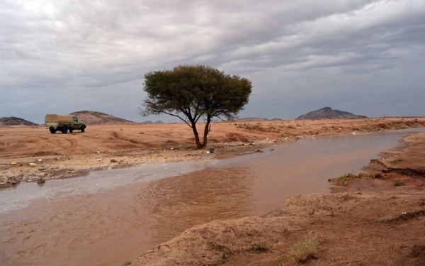
The protection in the Imam Abdulaziz Bin Mohammed Reserve is divided into two levels: the first for wild animals, and the second for the environment and trees. The Rawdat al-Khuraim, which was incorporated into the Imam Abdulaziz Reserve in the Kings' Reserve, is distinguished by its green nature and water channels. Several torrents flow into it, the most important of which is Shuaib al-Tawqi. It is also crossed by several valleys such as: Khwaish, Thilan, and al-Thumamah.
King Abdulaziz Royal Reserve
It is one of the seven royal reserves in the Kingdom. It is located to the north of the Riyadh Province and is 185 km away from the capital. On June 2, 2018, a royal decree was issued to convert the Tanhat and Khafs reserves and the adjacent areas to a royal reserve under the name of King Abdulaziz Reserve.
The reserve spans an area of about 15,700 km². It falls under the jurisdiction of the Council of Royal Reserves, which is headed by the Crown Prince and Prime Minister, Prince Mohammed Bin Salman. The reserve's board of directors is chaired by Prince Abdulaziz Bin Saud Bin Nayef.
After the incorporation of Rawdat al-Tanhat, the King Abdulaziz Reserve has become a popular tourist destination that welcomes tourists of various nationalities. It has been mentioned in several ancient and contemporary Arabic poems and was an official park for the founder, King Abdulaziz Bin Abdulrahman Al Saud and his sons after him.
The area is distinguished by the fertility of its soil and its diverse vegetation. Several valleys flow through it, the most important of which are: Wadi al-Shawki, which is the largest, Wadi al-Tairi, Wadi al-Atk, and Wadi al-Wudai. Trees like Acacia and Ziziphus spina-christi are abundant in the area. Moreover, various flowers like daisies, Ranunculus, and lavender flourish there.
Desert plants in the deserts of the Kingdom
Calligonum comosum tree
It is a leafless shrub that lacks leaves and belongs to the Polygonaceae family. It is part of the Calligonum genus. This plant is widespread in desert environments and is considered a medium-height plant and shrub. Its branches are always green, tough, and drooping. The stems grow clustered, surrounded by sand. It produces seasonal flowers in the spring, which are white but tend towards yellow, and there are also red ones. Its fruits are spherical with soft spines.
The Calligonum comosum tree is widespread in the deserts of the Kingdom and is the most prevalent plant in the Empty Quarter Desert. It is distributed across most of its regions, densely concentrated in certain eastern, southern, southwestern, and southeastern parts. It is also found in some central parts. Among the areas where it thrives are: al-Habak, al-Aruq al-Mu'tarida, al-Qa'd, al-Sawahib, Aruq al-Awarak, Aruq al-Abl, and one of the most famous is Abl Ghamghima.
The Calligonum comosum grows on sand dunes and helps stabilize them. Its long taproots allow it to access water deep underground. It also thrives in flat environments and valleys. The tree is planted around farms as a windbreak. It is a fast-growing shrub in sandy dunes, gravelly, and rocky soils. It does not require a lot of water and is resilient to the harsh hot climate.
The Calligonum comosum shrub is planted along roadsides as a means to stabilize the sand. It is versatile in its uses, it can be found in city centers, at city entrances, in squares, along roads, and avenues. Additionally, it is used as a barrier to combat desertification. TheCalligonum comosum is essential for camel grazing, and its branches are used as firewood. It's a pleasant shrub with edible flowers that emit a fragrant smell, and it reproduces through both seeds and cuttings.
Cornulaca monacantha
The plant known as Cornulaca monacantha and abbreviated in Arabic as al-Hadh, with its plural form Ahwadh, belongs to the Sarcocaulon and Rootharat families. It is prevalent in the Empty Quarter Desert in the Kingdom and is the second most widespread plant there after al-Abl. It is densely found in specific locations in the eastern and central provinces.
Cornulaca is a branching woody bush with short leaves whose color tend to be blue-green and turns to white or yellow when the plant dies. It has ragged fringes and a single petal in each of its flowers. Its fruits usually sprout in summer, and they are either orange or brown.
Cornulaca spreads in the Empty Quarter Desert as an east-to-west strip. Many areas within this Province are named after its Arabic name (Hadh) with prefixes added to its name such as Hadh Jamshan, Hadh al-Fida, Hadh Shakwa, Hadh al-Bawh, Hadh Faris, Hadh Banu Zinan, Hadh al-Shwaiklah and Hadh al-Aatrat.
Rhanterium epapposum
It is a short, round-shaped, and regular shrub that belongs to the Asteraceae family. Its native habitat is the Arabian Peninsula, Kuwait, and tropical regions. It is cultivated in the city of Riyadh in the Kingdom. The shrub quickly adapts to desert conditions and serves as a food source for camels.
Rhanterium epapposum tree grows typically and reaches a height of about eighty cm. It has a deep taproot and its leaves are deciduous, alternate, lance-shaped, and small in size. They retain their color during the summer if watered. The branches are silvery-white in color. The flowers are yellow and small, about 0.7 cm in size. They bloom from March until mid-June. The fruit is sparse, containing six to eight seeds, each approximately 0.2 cm in size. The seeds spread via wind or water dispersal.
Lycium shawii shrub
It is a shrub from the Solanaceae family. Its native habitat is the southwestern part of Africa, the Mediterranean basin, and subtropical lands. It is known for its distribution across the Arabian Peninsula and is considered one of the desert plants cultivated in the vicinity of Riyadh in the Kingdom.
The Lycium shawii shrub is resilient in urban and dry environments and is sensitive to waterlogged conditions. It can survive without irrigation and can withstand high salinity levels estimated at 3,500 parts per million. It also has a frost tolerance down to -9 degrees Celcius.
The Lycium shawii grows up to a height of four m and its branches spread up to six m. It is highly branched and carries small thorns. It has small dark green leaves and star-shaped flowers with a diameter of about 7 mm, which are white and appear in the spring. It produces fleshy, pea-sized, red fruits. The Lycium shawii shrub is attractive to birds and bees, it can adapt to desert conditions and can withstand drought, frost, wind, grazing, and high temperatures.
The Haloxylon persicum bush
It is a shrub from the Chenopodiacea family, devoid of thorns, native to the Kingdom, and growing in sandy areas that cover saline soil in the northern parts of the Kingdom. It naturally reproduces through seeds and can sometimes be affected by pests.
The Haloxylon persicum is characterized by its perpetual greenness. It has slender branches on which small-sized flowers grow. It reaches a height of up to four m and has a large, thick root that grows directly downward. It typically grows in light sandy and silty soil, but can also thrive in poor, alkaline, and saline conditions. It is a plant that requires direct sunlight and is resistant to water scarcity.
Uruq al-Shaybah
What are Uruq al-Shaybah
Uruq al-Shaybah are high and rugged sand dunes located in the northeastern part of the Empty Quarter Desert in the Kingdom. To the north, they are bordered by the path of Fadh, the international boundary between the Kingdom and the United Arab Emirates. To the north, they are bounded by Ramlah al-Riyaadat and Ramlah Zarara, and al-Bateen and al-Jawa (or al-Yawa) region located in the United Arab Emirates. To the south, they are bordered by Ramlah al-Ghafah and transverse dunes. To the east, they are bordered by Ramlah al-Ghafah, Sabkhat Umm al-Samim, and al-Jaddah. To the west, they are bordered by al-Kadn.
Uruq al-Shaybah Components
Uruq al-Shaybah consists of intricate, intertwined, and overlapping crescent-shaped dunes. Small dunes have grown on their backs, as have deep, rugged depressions. Al-Shaybah dunes are distinguished by their elevation above the ground, as they rise above their surroundings, especially in their western parts. Some of their peaks rise about two hundred m above the surrounding area, making them difficult to traverse except by specific routes. Meanwhile, in their eastern parts, these dunes widen and diverge, turning into longitudinally extended intricate walls with star-shaped dunes at their tops. In general, Uruq al-Shaybah stretches from west to east and is considered among the most challenging and rugged areas of the Empty Quarter Desert. Their crescent dunes have steep faces sloping towards the south and are bounded by broad, low valleys covered mostly by wet saline flats. The elevation of these valleys above sea level ranges between fifty and one hundred m.
Uruq al-Shaybah Ressources
In the depressions amidst Uruq al-Shaybah, there is a large collection of ancient water sources and artesian wells that Aramco drilled during its survey of the Empty Quarter Desert for oil and gas exploration. Aramco also established an oil complex amidst the sands of al-Shaybah in al-Shaybah oil field area. The complex includes a residential compound, oil production plants, and a paved airstrip. Additionally, a pipeline was constructed to transport the field's production to the company's plants in Buqaiq. Adjacent to it, a paved road was built to connect the complex to the Batha-Salwa road. There's also a meteorological station located in the Shawalah area near the al-Shaybah complex. Some of the most important wells that Aramco drilled in the dunes of al-Shaybah include Ibn Obaid, al-Hashwan, al-Umar, Ibn al-Rubaie, al-Subyat, and al-Tarfa.
The sandy landscapes of Uruq al-Shaybah
Among the sandy features in Uruq al-Shaybah are: al-Alqa'a, Mubkhout, al-Sindi, Ibn Yamna, al-Manahil, al-Mankhaz, al-Dhbaa, al-Qat', Ibn Anouda, Neila, Ramla Ibn Saeedan, Uruq Abu Mrikha, Uruq al-Sarat, Uruq Umm al-Zumul, and Shaqa Marazim. It also includes Sabkhat al-Azzaf. The vegetation dominating Uruq al-Shaybah includes Cornulaca monacantha, Calligonum comosum, al-Andab, and Tribulus omanense. Additionally, Haloxylon persicum grows on its eastern edges.
Sabkhat al-Humr
What is Sabkhat al-Humr
Sabkha al-Humr, locally known as Batn al-Tarfaa, is one of the four largest sabkhas in terms of area within the Empty Quarter Desert in the Kingdom. The locals also refer to it as Batn al-Tarfaa named after the Tarfaa mountains located on its eastern edge. It is among the lowest regions in the Kingdom in terms of altitude; its surface is about twenty-four m below sea level. Located south of al-Batha border crossing with the United Arab Emirates and to the west of Sabkha Mati, it used to be the endpoint of Wadi al-Sahbaa before the sands of al-Dahnah and al-Jafurah obstructed its course.
Sabkhat al-Humr site
The area is located in a vast depression called Jaw al-Manayif in al-Jayban Province, at the center of Jaw Batiheen. It's positioned to the south of al-Batha border center with the United Arab Emirates and to the west of Sabkha Mati. The area is bounded by al-Manayif Mountains to the northwest, al-Muhna Mountains to the south, and the Tarfaa Mountains to the east. It stretches longitudinally from the northeast to the southwest, with a length of about twenty km and a width of about seven km. It's bordered to the west by the paved al-Shaibah road. On its surrounding eastern edge, there are some ancient water sources.
Sabkhat al-Humr ressources
Sabkhat al-Humr includes some springs that flow on the surface of the ground. In its center, there is a circular sand dune, and it is bordered to the west by the Shibah road. Some of its most famous springs are: al-Tarfa, Bir al-Sijm, Abi al-Daw resources, and Ghadeer al-Zilal. On its southern edges, there are some ponds and marshes that have formed due to the presence of some springs emerging from the rocks of the area. Additionally, grasses and shrubs grow along its courses.
Al-Qamair Region
The naming of al-Qamair Region
The term used for the region in the prevalent local terminology is al-Qamair and it is also referred to as al-Jaba'ir. The name is given to two areas, one eastern and the other western; they are separated by al-Dakaka Province, with the western one being more famous. It is the confluence zone of great sand dunes, where Uruq and ravines extending from the southwest of the Empty Quarter Desert near the governorates of Sharurah and al-Wadi'ah converge. It is located in the south-central part of the Empty Quarter Desert and ends near the northeastern outskirts of the ravines of: al-Isharat, al-Markha, Maritah, al-Riwa, Sardab, Ubar, Sharifah, al-Munhar, al-Hamidah, and al-Badi'.
Sandy features in al-Qamair Region
Al-Qamair consists of overlapping dunes and highlands that are rugged, elevated, and difficult to navigate, especially on its eastern and northern edges. Between these elevations, there are deep depressions in the form of pits and wells containing dry basins and salt flats. The height of its sands above sea level ranges between three hundred to four hundred m. It is bordered to the north and east by al-Dakaka, to the south by the dunes of al-Kharkhir, and the town of al-Kharkhir is located near its eastern edge.
Al-Qamair Region resources
A wide range of ancient water resources and wells are spread throughout the region, including: Maamoura, Shannah, Warsa, Farjah, Khadfayah, Ibn Suwailem, Tarwa, Abu Masjid, Wazm, Awbar, Sharifa, Khairan al-Adhani, Madima, Aba al-Afan, Aba al-Ashush, al-Manahil, and al-Ater, in addition to Brik and al-Mudhahn wells. It is traversed by the paved road that connects al-Kharkhir with Sharurah. Additionally, in one of its ravines, there is Jahaman Cave, which is a small limestone hill. The locals used to hide in it to hunt the deer that came to the water around it. There are also some archaeological pieces and pottery in the Obar ravine near the Ma'mura wells.
Al-Kadn Region
What is al-Kadn Region?
It is a vast sandy dune area, located in the northeast of the Empty Quarter Desert. It is confined between al-Batin and al-Batna and extends to al-Jawwah (al-Yawa) and al-Dhafra from the north, the intersecting veins and al-Habak from the south, and al-Shubaybah dunes especially from the east, and al-Muhrad from the west. The sand dunes in the al-Kaden Region generally slope towards the east, with an average height of about 150 m above sea level. Salt flats are abundant on their eastern edges close to Uruq al-Shaybah, and they are less frequent on the other edges. It is bisected from the north by the Shaybah road, which was constructed by Aramco to link the Shaybah field complex to the company's facilities in Buqayq. Located on its northern outskirts is the Shubaitah Center, affiliated with the Saudi border guards.
Sandy features in al-Kadn area
Al-Kadn is distinguished by the variety of its sand shapes and their ruggedness in the center. It consists of elevations and pyramidal dunes, as well as high and rugged depressions. These features are challenging to navigate except through specific pathways known only to those with experience. Al-Kadn is made up of crescent-shaped dunes in its eastern and southeastern parts, and it is considered a western extension of the Uruq Shaybah. Meanwhile, in its western parts, it consists of longitudinal dunes known as (Hamareer al-Kadn).
Al-Kadn Region resources
In the center of al-Kadn, there is a large collection of water resources and artesian wells drilled by Aramco. These include the wells of al-Tawil al-Shamali, al-Janoubi, and al-Kasah. Some of its water resources are Khairan Ibn Awn, Umm Ghafil, Aba al-Rawa'il, Aba al-Qardan, Hamoudi, al-Mutbaqah, Abu Tinah, Fattan, Tahmimah, Ibn Ham, Ibn Qanas, Ibn Suwaidan, Bakhit, al-Quraini, al-Hairan, and Abu Dhafir.
The sands of Kadn include Arq Heniyah, Hazm, Dahrooj, Alam al-Faqarah, Naqa al-Thor, Alam Ibn Suwaidan, Alam al-Kasah, Qa’idah Ibn Husainah, Arq Tahmimah, Alam Abu Ruwaikah, Arq al-Abl, Alam Wan, Umm Katuf, Khallah Abu Ruwaikah, Haqnah al-Dahu, Haaz al-Fawarah located between it and al-Habak. Most of its sands are dominated by plants such as Calligonum comosum, Tribulus omanense, al-Andab, Stipagrostis, and Centropodia.
Related quizzes
Related articles


