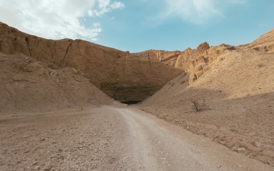
Caves in the Kingdom of Saudi Arabia consist of geological formations locally known as duhul (dolines). They are scattered across the Kingdom and were used as shelters by humans in ancient times before becoming important tourist attractions nowadays. Approximately 1,826 caves and dolines were discovered until 2020. The formation of these caves resulted from several geologic processes. Caves boast many hydrological, economic, and cultural features.
Geologic formation of caves in Saudi Arabia
Some of the Kingdom's caves are characterized by housing or being surrounded by archaeological inscriptions dating back to millennia. Moreover, some offer a suitable environment for wildlife and other living organisms, such as bats, birds, and mammals. Caves in the Kingdom consist of unique rock formations, distinguished by stalactites and stalagmites formed as a result of water carving within the rocks' inner surfaces. On the other hand, rock formations surrounding caves contribute to the sites' aesthetics.
Caves consist of air-filled spaces. They were created by the movement of water over rocks in ancient times, where water caused rocks to dissolve over long periods, ultimately forming openings and tunnels within the earth. These formations are often connected to one another, where such connection is established by the direction of water leaks through the rocks' fissures and cracks until it deposits underground. The Kingdom houses several types of caves, including:
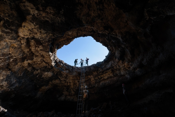
- Lava-Tube Caves: found in various regions of the Kingdom, most notably in dark basaltic plateaus found among the western rocks of the Arabian Shield. These caves are known as the tubes of the valley, the crypts, or the lava-tube caves. They began to form during the Precambrian period. Notable examples include Harrat Nawasif, Harrat al Buqum, Harrat Kishb, Harrat Khaybar, Harrat al-Harrah, and Harrat Ithnain.
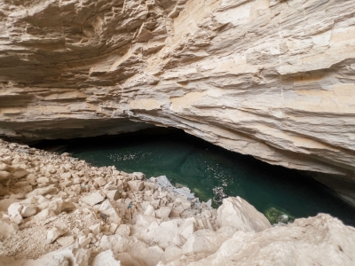
- Sedimentary rock caves: water leaks through dissolved limestone rocks greatly impact the formation of most caves, where cave formation within this setting is rather a slow process. In this respect, rainfall and wind help these rocks absorb small quantities of carbon dioxide. These rocks then become saturated with carbon dioxide absorbed from the soil. As a result, a light solution of carbonic acid is formed. This solution leaks to lower rock levels and dissolves base rock limestones, ultimately forming interconnected cavities and channels.
- Littoral caves: these caves consist of sea cliffs formed of fragile sea rocks impacted by seawater movement. The latter carves into weaker rocky layers faster than it does into solid rocks. As a result, caves are formed across weak areas at the bases of cliffs, mostly due to waves breaking therewith. Hence, rocks become subject to erosions, ultimately forming small circular protrusions and cavities that gradually widen before they turn into underwater caves located at the edges of cliffs.
Structure of caves in Saudi Arabia
Limestone stalactites and stalagmites are among the structures formed within caves due to the deposit of calcium carbonate upon the caves' ceilings and floors, where deposits are often parallel to the cave plane. Many water drops fall from the cave's ceiling to its floor, where they dry. Their calcareous content is deposited into the cave's floor where it forms stalagmites. It happens that stalactites and stalagmites meet, forming stalagnates, known for their large size. In fact, these wondrous rock formation phenomena often attract visitors to caves.
Connection between caves and bedouins
Bedouins dubbed caves duhul or duhula, referring to underground cavities housing waters. The locations of these caves along with their names are already known to them, upon noting that some caves may have more than one name. However, caves without water are called jabawa, with the term's singular form being jabu.
Cave tourism in Saudi Arabia
Caves offer a geologic and geomorphologic treasure. In fact, they are not only significant for aesthetic reasons, but they also offer information and details on the region's ancient climate, ground processes, fauna, and flora.
On the other hand, caves boast significant value for tourism. In fact, many caves are currently dedicated for tourism-related purposes within the framework of cooperation between the Ministry of Tourism and the Saudi Geological Survey. This cooperation seeks to promote cave tourism in the Kingdom. Related caves include Umm Jirsan Cave in Harrat Khaybar, al-Tahalib Cave, al-Fondok Cave, al-Murabba Cave in as-Samman area, 220 km northeast of Riyadh City, and the Black Scorpion Cave in the Northern Borders Province.
The Kingdom also houses caves boasting historical and Islamic value, including Hira Cave, east of Makkah al-Mukarramah, located around four km from the Grand Mosque. The cave is known as the site where Prophet Muhammad, peace be upon him (PBUH) used to pray and where he received his revelations. Another cave is Thowr Cave, located on Thowr Mountain, in Makkah al-Mukarramah, around four km south of the Grand Mosque. The cave is known as the place where the Prophet (PBUH) rested with Abu Bakr al-Siddiq, may Allah be pleased with him, on their way to al-Madinah al-Munawwarah.
Caves in the Kingdom vary in terms of area and depth. Shu'fan Cave is one of the Kingdom's largest caves. It spans approximately two km in length, with a height reaching around eight m. Its depth extends to eight hundred m below the surface. There is also Darb al-Najm Cave located in the eastern desert of al-Majma'ah. It consists of a cavity reaching a depth of about one hundred m. It is the most suitable cave for climbing enthusiasts.
Atlas of Caves in Saudi Arabia
In 2021, the Ministry of Environment, Water, and Agriculture issued the "Atlas of Caves in the Kingdom of Saudi Arabia." This guide seeks to identify and classify caves in the Kingdom to leverage these caves for underground water resources development and tourism purposes.
The guide identified and classified 1,826 caves and dolines across the Kingdom. It also offered a scientific introduction providing information on cave formation, identifying their coordinates, and featuring geologic and geographic maps accurately determining their locations. The guide determined caves that pose a threat to humans and properties, thus calling for devising preventive measures. It also sought to conduct research and leverage research outputs in scientific studies.
According to the Atlas, the Eastern Province houses the largest number of caves, with 680 caves and dolines, followed by the Northern Borders Province, with 542 caves and dolines. This high number is due to the presence of limestone formations and the provinces' topography. Moreover, there are also 152 caves and dolines located across water courses and valleys. These caves may be beneficial for studies and projects dedicated to feeding underground reservoirs. The Kingdom has 109 caves dedicated to tourism, including fifty-six caves and dolines supervised by the Ministry of Tourism and fifty-three proposed tourist attractions.
On the other hand, there are 1,237 caves and dolines that pose a threat to safety and security. These caves are located in nine provinces. The Atlas proposed the dedication of ten sites housing caves, located in the vicinity of cities in five regions, to train university students, conduct research, and leverage them in terms of scientific studies and the universities' field visits.
Related quizzes
Related articles


