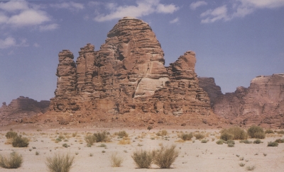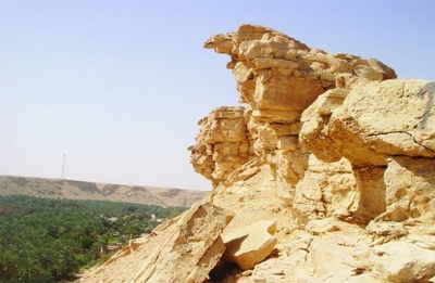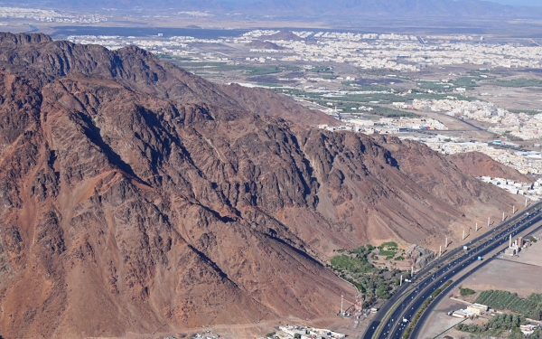
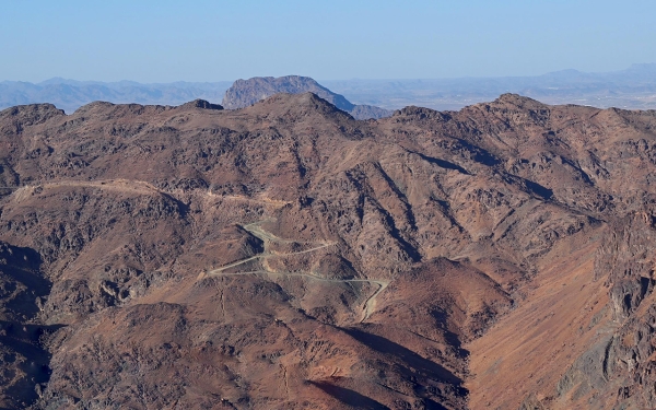
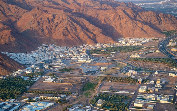
Mount Uhud is among the most famous mountains of al-Madinah al-Munawwarah, located in the western region of the Kingdom of Saudi Arabia. It represents a historical and geographical landmark. Located four km away from the Prophet's Mosque, the famous Battle of Uhud took place near it in the early days of Islam between the Muslims and the Quraysh. The battlefield witnessed the martyrdom of seventy Companions, most notably Hamzah Bin Abdulmuttalib, Prophet Muhammed's peace be upon him (PBUH) uncle, known in Islam as the Chief of the Martyrs.
Significance of Mount Uhud
Mount Uhud is one of the most renowned Islamic and tourist sites linked to the prophetic biography and its historical events. Visitors flock to it at all times, as it is one of the enduring historical places in al-Madinah al-Munawwarah. The Prophet (PBUH) said of it, "Uhud is a mountain that loves us and we love it." This statement led to its universal love and a desire among Muslims to visit it.
Recognizing its historical importance, Mount Uhud has been beautified and developed with creative touches. The nighttime lighting design harmoniously merges with the natural beauty of the mountain, inspired by the sunrise on the mountaintops. Pathways around the mountain have been enhanced to facilitate the movement of visitors to and from the site.
Fame of Mount Uhud
The history of Mount Uhud is intricately connected with the battle that took place between the Muslims led by Prophet Muhammed (PBUH) and the Quraysh, along with their allies from the tribes of Kinanah and Tihama, led by Abu Sufyan Bin Harb, in 625 CE, the third year of the Hijra (Islamic calendar). The Muslims were a thousand in number, while the Quraysh and their allies numbered three thousand.
Reason for naming Uhud
Three narratives exist regarding the naming of Uhud. The first suggests it was named for its unique terrain, distinct from other mountains, surrounded by plains and valleys. The second narrative proposes it was named after a giant named Uhud, the first to inhabit it. According to the third narrative, it was named symbolizing the oneness of Allah.
Historical relics of Mount Uhud
It contains historical inscriptions some of which have words of majesty, that date back over five centuries. Surrounding these inscriptions are remnants bearing some characteristics of the prophetic era, including the Fasah Mosque, where the Prophet Muhammed (PBUH) prayed Dhuhr and Asr prayers on the day of the Battle of Uhud. Near Mount Uhud, there is a small mosque at the edge leading to al-Mihras. It is now connected to modern buildings and surrounded by a few traditional houses, most of which have been demolished. Only a small portion remains, and al-Madinah Municipality has fenced it. Additionally, there is Mount al-Rumah, where some Muslims used it as a location to launch their arrows during the Battle of Uhud.
Nature of Mount Uhud
The mountain rises over a thousand m above sea level, with more than eight types of plants growing on it. It contains volcanic and igneous rocks of various colors, some dating back to the Cretaceous period. The mountain has natural cavities that store rainwater, preserving it until the next rainy season.
Uhud forms a range of interconnected mountains with multiple peaks and valleys, stretching over eight km in length and two km in width on its eastern side, while on its western side, it extends over more than three km. It is located north of al-Madinah al-Munawwarah, four km from the Prophet's Mosque, with its highest point about 1,077 m above sea level.
The mountain contains several natural depressions called al-maharis (singular: mehras). These maharis serve as natural reservoirs that retain rainwater for most of the year. They are located in the Jaraar Valley, known as the Haroon Valley, at ground level. The water in these maharis is pure and deep during the rainy season, gradually changing in color and taste but not disappearing until the rains of the following year.
Borders of Mount Uhud
To the east, it's bordered by al-Matar Road, Mount Tayab, and Mohammed Bin Abdulwahab Primary School. To the south, it's bordered by al-Shuhada District, farms on the foothills of Mount Uhud, and the Martyrs' Cemetery. A canal valley runs parallel to it, about a thousand m away. To the west, it's bordered by al-Tayariyah Neighborhood, farms, and al-Eyun Road. To the north, it's bordered by the non-Muslims' road and the livestock markets.
Vegetation cover on Mount Uhud
The plateaus of Uhud are covered with many trees and plants, including the Prophet's Almond, a small plant with broad leaves called by the Arabs arranged leaves. Additionally, there's the Ruby dock (Rumex vesicarius), a sour-tasting plant with pink leaves, and other plants like Arabian boxthorn (Lycium shawii), Acacia tortilis (Vachellia tortilis), Salam (Acacia ehrenbergiana), Sidr (Frangula alnus), Colocynth (Citrullus colocynthis), and camel thorn (Vachellia erioloba).
Related quizzes
Related articles

